
Geoinformatics
Technische Universität Dresden · Dresden, Europe
Duration
24 mo
Tuition
No tuition fee
sourcedIntake
Winter semester
English
—
Winter semester intake. Most universities admit on a rolling basis — we confirm the exact application deadline for your profile, free.
Course details verified 10 Sep 2026 — intakes, entry requirements and course facts · official source
Fee sourced Taken from the university's published fees page, not re-checked since — confirm it before you budget. See the university fees page.
About this programme
The content of the Master's degree programme in Geoinformatics at TU Dresden covers in-depth fundamentals as well as current development and research trends in geoinformatics. The Master's degree programme offers three areas of specialisation: Geodata acquisition: laser scanning, photogrammetry, optical 3D measurement methods, GNSS and remote sensing as well as methods of data analysis and data integration Geodata services: modelling, methods and technologies for geodata infrastructures as well as the development of geoinformation services and web applications Geodata visualisation: methods of geovisual analysis and cartographic communication, methods of automatic generalisation, as well as mobile and field-based cartography These focal points are supplemented by content from computer science to expand methodological knowledge (e.g. virtual reality, (geo)databases, (geo)software development) and from the environmental sciences as an essential application domain of geoinformatics (e.g. environmental risks, spatial planning). In-depth seminars and projects deal with current research topics in geoinformatics (e.g. sensor networks, GI usability, web applications for decision support, geodata fusion, etc.) In addition, key qualifications are taught in the following areas: foreign languages, management methods, personnel management, marketing, work organisation, contract law, cultures, rhetoric, presentation. In four semesters, the course comprises six compulsory modules and eight compulsory elective modules, in which courses can be selected from compulsory elective catalogues. This allows students to set their own priorities for individual specialisation. The fourth semester is used to complete and defend the Master's thesis.
Intakes & deadlines
Winter semester
Dates confirmed for your profile · Open
Summer semester
Dates confirmed for your profile · Open
Entry requirements
-
English
E.G. TOEFL iBT (before 2026): 72 Reading: 18 Listening: 17 Speaking: 20 Writing: 17 IELTS Academic: 5.5
-
Prerequisites
Applicants must hold a Bachelor’s degree (or equivalent) in Environmental Informatics, Geodesy, Geoinformatics, Geography, or a related field with sufficient background in spatial sciences and IT. Proof of English language proficiency is required.
-
Documents
SOP, LOR & Resume — generate them free in 2 minutes.
Fees & scholarships
No tuition fee tuition (sourced). We confirm the exact costs and the scholarships you qualify for at Technische Universität Dresden — free, for your profile.
Other programmes at Technische Universität Dresden
AI, Regulatory Affairs & Transformation in Medical Technology (MBA)
€4,170/yr Tuition · sourced 2 years Duration View details TD Technische Universität DresdenAir Transport and Logistics
No tuition fee Tuition · sourced 2 years Duration View details TD Technische Universität DresdenBiochemistry
No tuition fee Tuition · sourced 2 years Duration View details TD Technische Universität DresdenChemistry
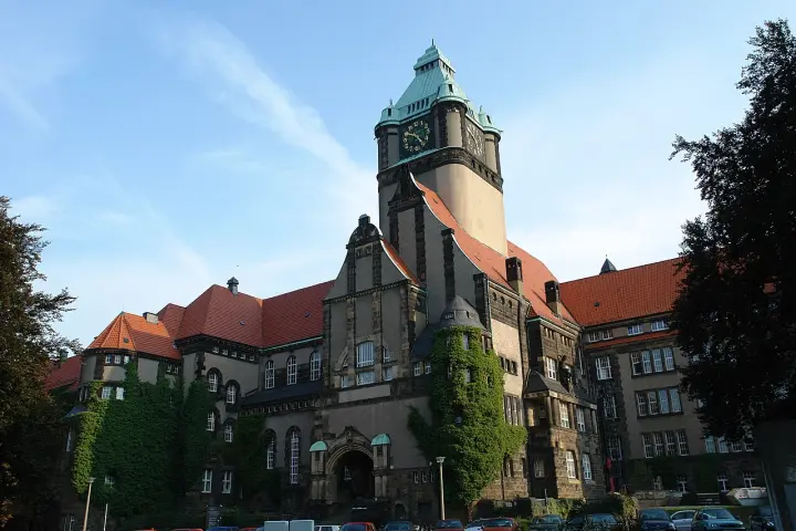
No tuition fee Tuition · sourced 2 years Duration View detailsCampus photos on this page: Hullbr3ach (CC BY-SA 2.5) — via Wikimedia Commons.
Geoinformatics — FAQs
5 questions
Tuition is No tuition fee. Taken from the university's published fees page, not re-checked since — confirm it before you budget. We confirm the current fee and the scholarships you qualify for — free.
The main intake is Winter semester. Most universities admit on a rolling basis — we confirm the exact deadline for your profile, free.
Applicants must hold a Bachelor’s degree (or equivalent) in Environmental Informatics, Geodesy, Geoinformatics, Geography, or a related field with sufficient background in spatial sciences and IT. Proof of English language proficiency is required. English: E.G. TOEFL iBT (before 2026): 72 Reading: 18 Listening: 17 Speaking: 20 Writing: 17 IELTS Academic: 5.5.
The programme runs about 24 months full-time.
Yes — shortlisting, SOP, LOR, Resume, application, scholarships and visa guidance are all free. We're paid by partner universities, not by you.
Apply to Geoinformatics — free help
A counsellor calls you back during office hours — 9am to 8pm IST, Mon to Sat. We are open now.