
Master of Science in Geospatial Technologies
University of Münster · Münster, Europe
Duration
18 mo
Tuition
€1,700/yr
sourcedIntake
Winter semester
English
—
Winter semester intake. Most universities admit on a rolling basis — we confirm the exact application deadline for your profile, free.
Course details verified 09 Sep 2026 — intakes, entry requirements and course facts · official source
Fee sourced Taken from the university's published fees page, not re-checked since — confirm it before you budget. See the university fees page.
About this programme
Spatial and temporal aspects are at the heart of many pressing societal problems (e.g. achieving the UN Sustainable Development Goals), and there is a lack of experts capable of dealing with them properly. The overall aim of the International Master's Programme in Geospatial Technologies is thus to prepare students to exploit new geospatial technologies to support environmental and societal decision-making affecting the future of our planet. The University of Münster (UM), Germany, the Universitat Jaume I (UJI), Spain, and the Universidade Nova de Lisboa (UNL), Portugal, are complementary institutions with expertise in key research areas and teaching in the field of geospatial technologies. Consequently, the programme can cover interdisciplinary and current topic areas such as informatics, data analytics, remote sensing, spatial statistics and Geographic Information (GI) Science while also providing students with the opportunity to apply these to relevant problems in practical (team) projects. The partners have been cooperating in several international projects for more than 15 years, including in a previous EMJM as well as in a European PhD programme (International Training Network) on Smart Open Cities. This expertise in running international training programmes, the composition of the consortium, and the tightly integrated structure of the degree programme, ensure that the course content is up-to-date, teaching is delivered to a high standard and essential transferable skills are acquired by the students. The standard period of study is three semesters, including all examination requirements and the Master's thesis. The International Master's programme requires 90 ECTS credit points. Based on the successful Master's examination, the three universities will award the joint degree “Master of Science” (MSc) with the designation “in Geospatial Technologies”. For detailed information, please check our website. The Master’s programme will be conducted with up to 32 students. Half of them attend their first semester at UJI, half at UNL. Intentionally, UJI and UNL offer courses with a different focus, in order to address the different backgrounds and requirements of the incoming students. Both partners offer basic modules in GI, although with different levels of intensity. The programme at UJI stresses the computing aspects of GI such as computer graphics and web services, whereas the programme at UNL is more oriented towards the processing and modelling aspects of geographic information, including topics such as “Remote sensing” and “Geospatial data mining”. As for the other modules, UJI is more informatics-oriented (modules “Informatics and mathematics” and “New technologies”). UNL provides modules in “Mathematics and statistics” and “Data modelling”. UNL offers different paths within its modules by means of alternative courses, e.g. a student with a background in social sciences such as geography and some previous know-how in informatics would rather choose “Descriptive statistics” and “Data analysis", whereas a more informatics-related student would choose “Mathematical statistics” and “Data mining”. For the second semester, all students attend the courses at UM. The first module covers “Fundamentals in GI Science”. The second module “Advanced topics in GI Science” covers knowledge on ongoing research and research projects, thus preparing the students for their own research in the Master's thesis. Optionally, courses of this module can be replaced by an annual summer school organised by UM, UJI, or UNL, or by work in ongoing research projects of one of the partners’ research groups. The third module mediates additional “Core competences” the students will need for their Master's thesis as well as for their future professional careers: “Research methods in GI Science” and “Project management in GI projects”. As for the third semester (Master's thesis), students can choose one of the three universities, whereas the applicants wi
Intakes & deadlines
Winter semester
Dates confirmed for your profile · Open
Entry requirements
-
English
E.G. TOEFL iBT (since 2026): 3 Reading: 3 Listening: 3 Speaking: 3 Writing: 3
-
Prerequisites
For a detailed description, please check official information on our website. A requirement for admission is to have completed at the time of application an adequate Bachelor's degree of six semesters full time (= 180 ECTS credit points) or more, as recognised by the partner universities in Germany, Portugal, or Spain, for admission to graduate studies. Areas of geographic information, e.g. geography, ecology, urban, regional and environmental planning, logistics/transportation, energy provision, surveying, agriculture, forestry, and related We also particularly welcome students with a degree in computer science. Within previous studies or professional experience, we expect that applicants have already acquired basic IT/GI skills. An official English language test is required.
-
Documents
SOP, LOR & Resume — generate them free in 2 minutes.
Fees & scholarships
€1,700/yr tuition (sourced). We confirm the exact costs and the scholarships you qualify for at University of Münster — free, for your profile.
Other programmes at University of Münster
Business Administration
No tuition fee Tuition · sourced 2 years Duration View details MÜ University of MünsterBusiness Development
No tuition fee Tuition · sourced 2 years Duration View details MÜ University of MünsterComparative and Global Law (LLM)
No tuition fee Tuition · sourced 1 year Duration View details MÜ University of MünsterData Science
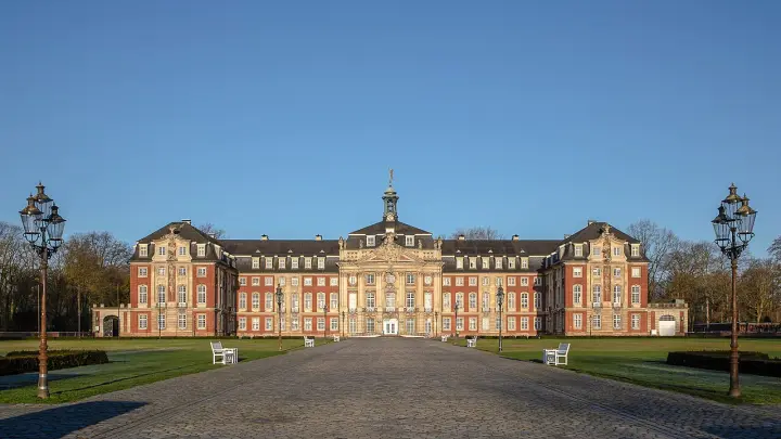
€4,238/yr Tuition · sourced 2 years Duration View detailsCampus photos on this page: Dietmar Rabich (CC BY-SA 4.0) — via Wikimedia Commons.
Master of Science in Geospatial Technologies — FAQs
5 questions
Tuition is €1,700/yr. Taken from the university's published fees page, not re-checked since — confirm it before you budget. We confirm the current fee and the scholarships you qualify for — free.
The main intake is Winter semester. Most universities admit on a rolling basis — we confirm the exact deadline for your profile, free.
For a detailed description, please check official information on our website. A requirement for admission is to have completed at the time of application an adequate Bachelor's degree of six semesters full time (= 180 ECTS credit points) or more, as recognised by the partner universities in Germany, Portugal, or Spain, for admission to graduate studies. Areas of geographic information, e.g. geography, ecology, urban, regional and environmental planning, logistics/transportation, energy provision, surveying, agriculture, forestry, and related We also particularly welcome students with a degree in computer science. Within previous studies or professional experience, we expect that applicants have already acquired basic IT/GI skills. An official English language test is required. English: E.G. TOEFL iBT (since 2026): 3 Reading: 3 Listening: 3 Speaking: 3 Writing: 3.
The programme runs about 18 months full-time.
Yes — shortlisting, SOP, LOR, Resume, application, scholarships and visa guidance are all free. We're paid by partner universities, not by you.
Apply to Master of Science in Geospatial Technologies — free help
A counsellor calls you back during office hours — 9am to 8pm IST, Mon to Sat. We are closed right now, so your request is first in line when we reopen.