
Geodetic Engineering
Rheinische Friedrich-Wilhelms-Universität Bonn · Bonn, Europe
Duration
24 mo
Tuition
No tuition fee
sourcedIntake
Winter semester
English
—
Winter semester intake. Most universities admit on a rolling basis — we confirm the exact application deadline for your profile, free.
Course details verified 10 Sep 2026 — intakes, entry requirements and course facts · official source
Fee sourced Taken from the university's published fees page, not re-checked since — confirm it before you budget. See the university fees page.
About this programme
The Master's programme Geodetic Engineering is dedicated to students with a BSc in Geodesy and Geoinformation or related topics, such as Computer Science, Mathematics, Physics, Geosciences or Electrical Engineering. It is a full-time programme taught entirely in English. The standard period of study is four semesters, including the Master's thesis. The programme offers three profiles, which cover the main research fields of our institute: Mobile Sensing and Robotics Geodetic Earth System Science and Data Analysis Geoinformation and Spatial Development Each student will choose one area as a major and a second area as a minor topic. Depending on the student's interests, the curriculum allows the student to focus almost entirely on one main topic or on a broader range of topics. Graduates will be equipped with skills and tools to recognise and solve geodetic engineering problems. During their studies, they will participate in current research projects. The Master’s programme provides an entry qualification for PhD programmes. The Geodetic Engineering programme is extended over 24 months and is structured into mandatory modules and compulsory elective modules, including teaching units with a duration of one semester. An exam completes each module. Three different types of modules are offered: lectures, seminars and projects. Credit points (CP) are the basis of evaluation. By the beginning of the first semester, the students are required to choose a major and a minor profile out of the following options: Mobile Sensing and Robotics Geodetic Earth System Science and Data Analysis Spatial Information and Development The curriculum of the MSc programme Geodetic Engineering is structured as follows: The first semester offers mandatory advanced modules covering the basic knowledge that will be required for the remaining programme. Lectures and exercises cover the following topics: Coordinate Systems, GNSS, Statistics and Adjustment Theory, Geoinformation Systems and Earth Observation. For each student, an individual study plan will cover topics that were not provided by the student's prior education. Chosen profiles will be introduced via two mandatory modules. In the second and third semesters, students intensify their knowledge by taking one mandatory and three to five compulsory modules from their major profile. From the minor profile or from external offers, they may choose up to three compulsory elective modules. Two project modules introduce the students to current research topics and train them to be able to do self-sufficient research. These topics are meant to be preparation for the Master's thesis and therefore should only be selected from the major profile. The last study semester is devoted to the Master's thesis. The Master's programme will be successfully completed once 120 CP have been obtained. Of these 120 CP, students will obtain 15 CP from advanced modules, 3 CP from the individual study plan, 30 to 42 CP from modules out of the major profile, 6 to 18 CP from modules out of the minor profile and/or external offers, 24 CP from the projects modules, and 30 CP from the Master's thesis.
Intakes & deadlines
Winter semester
Dates confirmed for your profile · Open
Entry requirements
-
English
E.G. TOEFL iBT (before 2026): 90 TOEFL iBT (since 2026): 4.5 IELTS Academic: 6.5
-
Prerequisites
Applicants must have a three-year Bachelor of Science degree in Geodesy, Geoinformation or related topics, such as Geoscience, Computer Science, Mathematics, Physics or Electrical Engineering. In detail, applicants must have a total of at least 24 credits from at least two of the following three subjects: Mathematics, Physics, Programming a total of at least 48 credits from at least two of the following six research areas Physical Geodesy, Space Geodesy, Geodynamics and Earth System Research Data Analysis, Modelling and Scientific Computing in the context of Geoscience Photogrammetry, Remote Sensing, Computer Vision and Robotics Geodetic Measurement Technology, Engineering Geodesy and Satellite Measurement Technology Algorithmics, Spatial Databases, Geo-Information and Geo-Information Systems Urban Development, Land Readjustment and Real Estate Evaluation and Land Management Based on your application documents, the examination board will decide your eligibility for the Master's programme. Before you apply, please check the requirements carefully.
-
Documents
SOP, LOR & Resume — generate them free in 2 minutes.
Fees & scholarships
No tuition fee tuition (sourced). We confirm the exact costs and the scholarships you qualify for at Rheinische Friedrich-Wilhelms-Universität Bonn — free, for your profile.
Other programmes at Rheinische Friedrich-Wilhelms-Universität Bonn
Agricultural and Food Economics (AFECO)
No tuition fee Tuition · sourced 2 years Duration View details RFW Rheinische Friedrich-Wilhelms-Universität BonnAgricultural Sciences and Resource Management in the Tropics and Subtropics (ARTS)
No tuition fee Tuition · sourced 2 years Duration View details RFW Rheinische Friedrich-Wilhelms-Universität BonnAnthropology of the Americas
No tuition fee Tuition · sourced 2 years Duration View details RFW Rheinische Friedrich-Wilhelms-Universität BonnApplied Linguistics
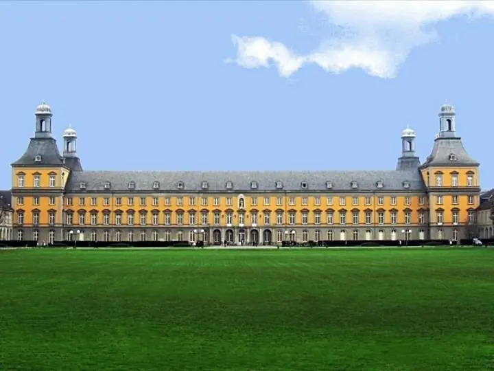
No tuition fee Tuition · sourced 2 years Duration View detailsCampus photos on this page: Daniel Tibi (Dti) | daniel-tibi.de (Public domain) — via Wikimedia Commons.
Geodetic Engineering — FAQs
5 questions
Tuition is No tuition fee. Taken from the university's published fees page, not re-checked since — confirm it before you budget. We confirm the current fee and the scholarships you qualify for — free.
The main intake is Winter semester. Most universities admit on a rolling basis — we confirm the exact deadline for your profile, free.
Applicants must have a three-year Bachelor of Science degree in Geodesy, Geoinformation or related topics, such as Geoscience, Computer Science, Mathematics, Physics or Electrical Engineering. In detail, applicants must have a total of at least 24 credits from at least two of the following three subjects: Mathematics, Physics, Programming a total of at least 48 credits from at least two of the following six research areas Physical Geodesy, Space Geodesy, Geodynamics and Earth System Research Data Analysis, Modelling and Scientific Computing in the context of Geoscience Photogrammetry, Remote Sensing, Computer Vision and Robotics Geodetic Measurement Technology, Engineering Geodesy and Satellite Measurement Technology Algorithmics, Spatial Databases, Geo-Information and Geo-Information Systems Urban Development, Land Readjustment and Real Estate Evaluation and Land Management Based on your application documents, the examination board will decide your eligibility for the Master's programme. Before you apply, please check the requirements carefully. English: E.G. TOEFL iBT (before 2026): 90 TOEFL iBT (since 2026): 4.5 IELTS Academic: 6.5.
The programme runs about 24 months full-time.
Yes — shortlisting, SOP, LOR, Resume, application, scholarships and visa guidance are all free. We're paid by partner universities, not by you.
Apply to Geodetic Engineering — free help
A counsellor calls you back during office hours — 9am to 8pm IST, Mon to Sat. We are open now.