
Geodesy and Geoinformatics – Specialisation in Geomatics
Leibniz University Hannover · Hanover, Europe
Duration
24 mo
Tuition
No tuition fee
sourcedIntake
Winter semester
English
—
Winter semester intake. Most universities admit on a rolling basis — we confirm the exact application deadline for your profile, free.
Course details verified 09 Sep 2026 — intakes, entry requirements and course facts · official source
Fee sourced Taken from the university's published fees page, not re-checked since — confirm it before you budget. See the university fees page.
About this programme
Geodesy and Geoinformatics (specialisation Geomatics) is an engineering and geoscience subject based on mathematics and physics and a close affinity to computer science, environmental science, law, and social sciences. Typical questions include engineering and geodetic monitoring of structures, capturing and use of environmental information, guidance of machines and vehicles, and remote sensing and researching of the system Earth. For geodata captured by modern measurement technology, there are many applications, for example, in regional planning, for location-dependent mobile services and navigation systems. This wide variety of tasks requires thorough knowledge in individual disciplines that are encountered in the broad spectrum of subjects in the programme of Geodesy and Geoinformatics at Leibniz University Hannover. Building on the broad content of the Bachelor's degree, the Master's programme offers students the chance to study numerous specific fields at an advanced level and to specialise in certain disciplines. In particular, current aspects of research and their advanced applications on the basis of selected projects are at the heart of the Master's programme. Besides the specialisation Geomatics being one optional track of the Master's programme in Geodesy and Geoinformatics, we also offer the specialisation in Navigation and Field Robotics (the teaching language is mostly English, but with mandatory German parts). It is intended to start a third specialisation, Remote Sensing and GIS. Any specialisation has to be chosen at the beginning of the application process. To do justice to the broad spectrum of the subject and constantly changing needs and methods, the Geodesy and Geoinformatics programme (specialisation in Geomatics) at Leibniz University Hannover covers a wide range of subjects. This programme is distinguished by its practical relevance. Alongside research-oriented theory, projects and seminars are deliberately designed to develop key competencies such as teamwork and problem-oriented actions. This combination makes it possible for graduates to choose from a broad spectrum of employment opportunities. In the Master's programme (specialisation Geomatics), students pursue independent research and development activities in industry or research institutes. In the first two semesters, there are activities which serve to summarise the basics in six disciplines: Engineering geodesy Physical geodesy Positioning and navigation Photogrammetry and remote sensing Geographic information systems Land and real estate management Building on the six compulsory modules in Geodesy and Geoinformatics, students can specialise in one or more specialist area(s) whereby one entire subject area (Geodesy or Geoinformatics) can never be completely deselected. In parallel, there are two project seminars, in which a complex research-oriented task is tackled in small groups. In an elective module, students are given the opportunity to attend courses from the Leibniz University's entire selection of courses. The submission of a Master's thesis completes academic studies.
Intakes & deadlines
Winter semester
Dates confirmed for your profile · Open
Summer semester
Dates confirmed for your profile · Open
Entry requirements
-
English
E.G. UNIcert® English: UNIcert® III telc English: telc English B2-C1 University PTE Academic: 76 IELTS Academic: 7 TOEFL iBT (since 2026): 5 Reading: 5 Listening: 5 Speaking: 5 Writing: 5 TOEFL iBT Home Edition (since 2026): 5 Reading: 5 Listening: 5 Speaking: 5 Writing: 5
-
Prerequisites
Academic admission requirements include a Bachelor's degree or equivalent degree in Geodesy and Geoinformatics or similar studies. Students should be familiar with the concepts of linear algebra, statistics and adjustment theory. They should have a basic understanding of digital imaging/computer vision, satellite positioning, and the Earth's gravity field. Important: they need to have programming skills. Prior to the final admission, the admission committee can invite applicants to a 20-minute online interview carried out by the lecturers of the degree programme. The interview helps determine if the applicant is capable of successfully completing the desired study programme and if additional courses have to be taken. In the case of missing basic competences in one or more of the above-mentioned fields, admission may only be granted if additional courses covering these basics are successfully completed. Note that in the case that the student has to complete additional courses, the duration of achieving the desired degree will exceed the regular two-year study duration. For more information regarding the application process, please refer to the course website: http://go.lu-h.de/gug-future-students.
-
Documents
SOP, LOR & Resume — generate them free in 2 minutes.
Fees & scholarships
No tuition fee tuition (sourced). We confirm the exact costs and the scholarships you qualify for at Leibniz University Hannover — free, for your profile.
Other programmes at Leibniz University Hannover
AI-Driven Mechatronics and Robotics (Mechatronics and Robotics Study Track)
No tuition fee Tuition · sourced 2 years Duration View details LH Leibniz University HannoverComputational Methods in Engineering (CME)
No tuition fee Tuition · sourced 2 years Duration View details LH Leibniz University HannoverComputer Science – Master of Science
No tuition fee Tuition · sourced 2 years Duration View details LH Leibniz University HannoverDouble Degree Master's Programme in Renewable Energy and Electrical Power Engineering
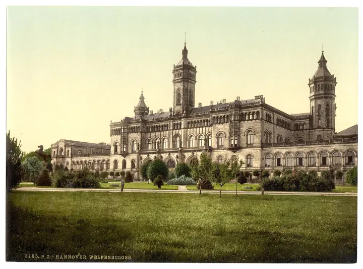
No tuition fee Tuition · sourced 2 years Duration View detailsCampus photos on this page: Unknown authorUnknown author (Public domain) — via Wikimedia Commons.
Geodesy and Geoinformatics – Specialisation in Geomatics — FAQs
5 questions
Tuition is No tuition fee. Taken from the university's published fees page, not re-checked since — confirm it before you budget. We confirm the current fee and the scholarships you qualify for — free.
The main intake is Winter semester. Most universities admit on a rolling basis — we confirm the exact deadline for your profile, free.
Academic admission requirements include a Bachelor's degree or equivalent degree in Geodesy and Geoinformatics or similar studies. Students should be familiar with the concepts of linear algebra, statistics and adjustment theory. They should have a basic understanding of digital imaging/computer vision, satellite positioning, and the Earth's gravity field. Important: they need to have programming skills. Prior to the final admission, the admission committee can invite applicants to a 20-minute online interview carried out by the lecturers of the degree programme. The interview helps determine if the applicant is capable of successfully completing the desired study programme and if additional courses have to be taken. In the case of missing basic competences in one or more of the above-mentioned fields, admission may only be granted if additional courses covering these basics are successfully completed. Note that in the case that the student has to complete additional courses, the duration of achieving the desired degree will exceed the regular two-year study duration. For more information regarding the application process, please refer to the course website: http://go.lu-h.de/gug-future-students. English: E.G. UNIcert® English: UNIcert® III telc English: telc English B2-C1 University PTE Academic: 76 IELTS Academic: 7 TOEFL iBT (since 2026): 5 Reading: 5 Listening: 5 Speaking: 5 Writing: 5 TOEFL iBT Home Edition (since 2026): 5 Reading: 5 Listening: 5 Speaking: 5 Writing: 5.
The programme runs about 24 months full-time.
Yes — shortlisting, SOP, LOR, Resume, application, scholarships and visa guidance are all free. We're paid by partner universities, not by you.
Apply to Geodesy and Geoinformatics – Specialisation in Geomatics — free help
A counsellor calls you back during office hours — 9am to 8pm IST, Mon to Sat. We are closed right now, so your request is first in line when we reopen.